1. Indiana Historic Maps

1816-2002. Indiana Historic Maps provides images of a small portion of maps that focus on Indiana. The majority of this collection focuses on maps produced pr...
1816-2002. Indiana Historic Maps provides images of a small portion of maps that focus on Indiana. The majority of this collection focuses on maps produced pr...
![29N 08E - Survey Map of Sanborn Township, Alpena County [Michigan]](https://geo.btaa.org/rails/active_storage/representations/redirect/eyJfcmFpbHMiOnsibWVzc2FnZSI6IkJBaHBBbE5YIiwiZXhwIjpudWxsLCJwdXIiOiJibG9iX2lkIn19--cfa53a27a0c2edbd73be30e3a2b4f1fb0278943d/eyJfcmFpbHMiOnsibWVzc2FnZSI6IkJBaDdCem9MWm05eWJXRjBTU0lJY0c1bkJqb0dSVlE2RW5KbGMybDZaVjkwYjE5bWFYUmJCMmtCeURBPSIsImV4cCI6bnVsbCwicHVyIjoidmFyaWF0aW9uIn19--63f58a7f811efdee35925b7691d3c2e688741bf3/feb452c5-a24d-4c63-831f-ac59987e7204.png)
1839. Clason, Lewis. A survey map of the Western half of Sanborn Township in Alpena County, Michigan, measured in 1839. Department of Natural Resources.
![29N 09E - Survey Map of Sanborn Township, Alpena County, Page 1 [Michigan]](https://geo.btaa.org/rails/active_storage/representations/redirect/eyJfcmFpbHMiOnsibWVzc2FnZSI6IkJBaHBBbFZYIiwiZXhwIjpudWxsLCJwdXIiOiJibG9iX2lkIn19--c79b650ff97459ed2703173926c9e2d2ea233310/eyJfcmFpbHMiOnsibWVzc2FnZSI6IkJBaDdCem9MWm05eWJXRjBTU0lJY0c1bkJqb0dSVlE2RW5KbGMybDZaVjkwYjE5bWFYUmJCMmtCeURBPSIsImV4cCI6bnVsbCwicHVyIjoidmFyaWF0aW9uIn19--63f58a7f811efdee35925b7691d3c2e688741bf3/65904312-e44d-4918-916c-9c82e97e38e3.png)
1839. Clason, Lewis. A survey map of the easternmost portion of Sanborn Township in Alpena County, Michigan, measured in 1839. Department of Natural Resources.
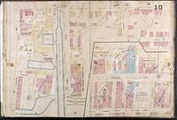
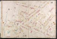
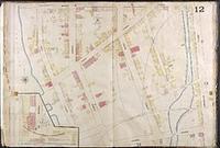
1867-1970. Sanborn Map Company. Digital Sanborn® Maps (1867-1970) delivers detailed property and land-use records that depict the grid of everyday life in more than 12,000 U.S. to... ProQuest Information and Learning.
1867-1970. Sanborn Map Company. ProQuest Sanborn Maps Geo Edition (1867-1970) provides digital access to thousands of large-scale maps of American towns and cities, searchable by ... ProQuest Information and Learning.
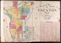
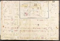
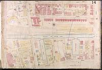
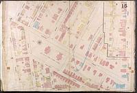
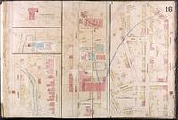
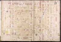
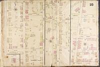
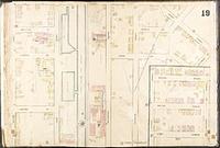
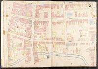
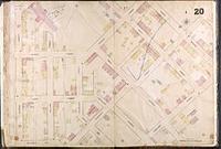
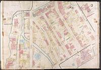
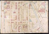
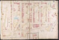
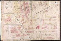
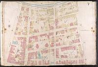
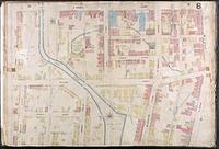
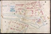
Sanborn Maps were originally created for assessing fire insurance liability and include detailed information about building construction and functi...
Sanborn Maps were originally created for assessing fire insurance liability and include detailed information about building construction and functi...
Sanborn Maps were originally created for assessing fire insurance liability and include detailed information about building construction and functi...
Sanborn Maps were originally created for assessing fire insurance liability and include detailed information about building construction and functi...
Sanborn Maps were originally created for assessing fire insurance liability and include detailed information about building construction and functi...
Sanborn Maps were originally created for assessing fire insurance liability and include detailed information about building construction and functi...
Sanborn Maps were originally created for assessing fire insurance liability and include detailed information about building construction and functi...
Sanborn Maps were originally created for assessing fire insurance liability and include detailed information about building construction and functi...
Sanborn Maps were originally created for assessing fire insurance liability and include detailed information about building construction and functi...
Sanborn Maps were originally created for assessing fire insurance liability and include detailed information about building construction and functi...
Sanborn Maps were originally created for assessing fire insurance liability and include detailed information about building construction and functi...
Sanborn Maps were originally created for assessing fire insurance liability and include detailed information about building construction and functi...
Sanborn Maps were originally created for assessing fire insurance liability and include detailed information about building construction and functi...
Sanborn Maps were originally created for assessing fire insurance liability and include detailed information about building construction and functi...
Sanborn Maps were originally created for assessing fire insurance liability and include detailed information about building construction and functi...
Sanborn Maps were originally created for assessing fire insurance liability and include detailed information about building construction and functi...
Sanborn Maps were originally created for assessing fire insurance liability and include detailed information about building construction and functi...
Sanborn Maps were originally created for assessing fire insurance liability and include detailed information about building construction and functi...
Sanborn Maps were originally created for assessing fire insurance liability and include detailed information about building construction and functi...
Sanborn Maps were originally created for assessing fire insurance liability and include detailed information about building construction and functi...
Between 1880 and 1950. Sanborn Map Company. Digital Sanborn® Maps (1867-1970) delivers detailed property and land-use records that depict the grid of everyday life in more than 12,000 U.S. to... ProQuest Information and Learning Company.
Between 1880 and 1950. Sanborn Map Company. Digital Sanborn® Maps (1867-1970) delivers detailed property and land-use records that depict the grid of everyday life in more than 12,000 U.S. to... ProQuest Information and Learning Company.
Between 1880 and 1950. Sanborn Map Company. Digital Sanborn® Maps (1867-1970) delivers detailed property and land-use records that depict the grid of everyday life in more than 12,000 U.S. to... ProQuest Information and Learning Company.
Between 1880 and 1950. Sanborn Map Company. Digital Sanborn® Maps (1867-1970) delivers detailed property and land-use records that depict the grid of everyday life in more than 12,000 U.S. to... ProQuest Information and Learning Company.
Between 1880 and 1950. Sanborn Map Company. Digital Sanborn® Maps (1867-1970) delivers detailed property and land-use records that depict the grid of everyday life in more than 12,000 U.S. to... ProQuest Information and Learning Company.
Between 1880 and 1950. Sanborn Map Company. Digital Sanborn® Maps (1867-1970) delivers detailed property and land-use records that depict the grid of everyday life in more than 12,000 U.S. to... ProQuest Information and Learning Company.
Between 1880 and 1950. Sanborn Map Company. Digital Sanborn® Maps (1867-1970) delivers detailed property and land-use records that depict the grid of everyday life in more than 12,000 U.S. to... ProQuest Information and Learning Company.
Between 1880 and 1950. Sanborn Map Company. Digital Sanborn® Maps (1867-1970) delivers detailed property and land-use records that depict the grid of everyday life in more than 12,000 U.S. to... ProQuest Information and Learning Company.
Between 1880 and 1950. Sanborn Map Company. Digital Sanborn® Maps (1867-1970) delivers detailed property and land-use records that depict the grid of everyday life in more than 12,000 U.S. to... ProQuest Information and Learning Company.
Between 1880 and 1950. Sanborn Map Company. Digital Sanborn® Maps (1867-1970) delivers detailed property and land-use records that depict the grid of everyday life in more than 12,000 U.S. to... ProQuest Information and Learning Company.
Between 1880 and 1950. Sanborn Map Company. Digital Sanborn® Maps (1867-1970) delivers detailed property and land-use records that depict the grid of everyday life in more than 12,000 U.S. to... ProQuest Information and Learning Company.
Between 1880 and 1950. Sanborn Map Company. Digital Sanborn® Maps (1867-1970) delivers detailed property and land-use records that depict the grid of everyday life in more than 12,000 U.S. to... ProQuest Information and Learning Company.
Between 1880 and 1950. Sanborn Map Company. Digital Sanborn® Maps (1867-1970) delivers detailed property and land-use records that depict the grid of everyday life in more than 12,000 U.S. to... ProQuest Information and Learning Company.
Between 1880 and 1950. Sanborn Map Company. Digital Sanborn® Maps (1867-1970) delivers detailed property and land-use records that depict the grid of everyday life in more than 12,000 U.S. to... ProQuest Information and Learning Company.
Between 1880 and 1950. Sanborn Map Company. Digital Sanborn® Maps (1867-1970) delivers detailed property and land-use records that depict the grid of everyday life in more than 12,000 U.S. to... ProQuest Information and Learning Company.
Between 1880 and 1950. Sanborn Map Company. Digital Sanborn® Maps (1867-1970) delivers detailed property and land-use records that depict the grid of everyday life in more than 12,000 U.S. to... ProQuest Information and Learning Company.
Between 1880 and 1950. Sanborn Map Company. Digital Sanborn® Maps (1867-1970) delivers detailed property and land-use records that depict the grid of everyday life in more than 12,000 U.S. to... ProQuest Information and Learning Company.
Between 1880 and 1950. Sanborn Map Company. Digital Sanborn® Maps (1867-1970) delivers detailed property and land-use records that depict the grid of everyday life in more than 12,000 U.S. to... ProQuest Information and Learning Company.
Between 1880 and 1950. Sanborn Map Company. Digital Sanborn® Maps (1867-1970) delivers detailed property and land-use records that depict the grid of everyday life in more than 12,000 U.S. to... ProQuest Information and Learning Company.
Between 1880 and 1950. Sanborn Map Company. Digital Sanborn® Maps (1867-1970) delivers detailed property and land-use records that depict the grid of everyday life in more than 12,000 U.S. to... ProQuest Information and Learning Company.
Between 1880 and 1950. Sanborn Map Company. Digital Sanborn® Maps (1867-1970) delivers detailed property and land-use records that depict the grid of everyday life in more than 12,000 U.S. to... ProQuest Information and Learning Company.
Between 1880 and 1950. Sanborn Map Company. Digital Sanborn® Maps (1867-1970) delivers detailed property and land-use records that depict the grid of everyday life in more than 12,000 U.S. to... ProQuest Information and Learning Company.
Between 1880 and 1950. Sanborn Map Company. Digital Sanborn® Maps (1867-1970) delivers detailed property and land-use records that depict the grid of everyday life in more than 12,000 U.S. to... ProQuest Information and Learning Company.
Between 1880 and 1950. Sanborn Map Company. Digital Sanborn® Maps (1867-1970) delivers detailed property and land-use records that depict the grid of everyday life in more than 12,000 U.S. to... ProQuest Information and Learning Company.
Between 1880 and 1950. Sanborn Map Company. Digital Sanborn® Maps (1867-1970) delivers detailed property and land-use records that depict the grid of everyday life in more than 12,000 U.S. to... ProQuest Information and Learning Company.