1. 1997 Digital Orthophotos, Twin Cities Metropolitan Area [Minnesota]
![1997 Digital Orthophotos, Twin Cities Metropolitan Area [Minnesota]](https://geo.btaa.org/rails/active_storage/representations/redirect/eyJfcmFpbHMiOnsibWVzc2FnZSI6IkJBaHBBb2x5IiwiZXhwIjpudWxsLCJwdXIiOiJibG9iX2lkIn19--bb3d81a841dbb92b33474f300ec17132815b2dbb/eyJfcmFpbHMiOnsibWVzc2FnZSI6IkJBaDdCem9MWm05eWJXRjBTU0lKYW5CbFp3WTZCa1ZVT2hKeVpYTnBlbVZmZEc5ZlptbDBXd2RwQWNndyIsImV4cCI6bnVsbCwicHVyIjoidmFyaWF0aW9uIn19--fb19b03b9eb4e78013d4cfb2b84169f3537e0279/019ab9e1-3263-40d2-adc9-10e6f03caa53.jpeg)
1997-04-01. Metropolitan Council of the Twin Cities Area. This dataset contains 265 digital, black and white orthophoto quarter-quadrangles (DOQs), 3.75' x 3.75', covering the 7 county Twin Cities (Minneap...
![1-Foot Contours, Apple Valley [Minnesota--Dakota County]](https://geo.btaa.org/rails/active_storage/representations/redirect/eyJfcmFpbHMiOnsibWVzc2FnZSI6IkJBaHBBdmRzIiwiZXhwIjpudWxsLCJwdXIiOiJibG9iX2lkIn19--6bc7643f2e7ef9605555a3116c64f3c71a679341/eyJfcmFpbHMiOnsibWVzc2FnZSI6IkJBaDdCem9MWm05eWJXRjBTU0lKYW5CbFp3WTZCa1ZVT2hKeVpYTnBlbVZmZEc5ZlptbDBXd2RwQWNndyIsImV4cCI6bnVsbCwicHVyIjoidmFyaWF0aW9uIn19--fb19b03b9eb4e78013d4cfb2b84169f3537e0279/26287ad9-7d76-4bce-b775-0bf192ac4f19.jpeg)
![1-Foot Contours, Burnsville [Minnesota--Dakota County]](https://geo.btaa.org/rails/active_storage/representations/redirect/eyJfcmFpbHMiOnsibWVzc2FnZSI6IkJBaHBBdmhzIiwiZXhwIjpudWxsLCJwdXIiOiJibG9iX2lkIn19--3ae274a51f8984aef6b81f33594b3dc821c73a47/eyJfcmFpbHMiOnsibWVzc2FnZSI6IkJBaDdCem9MWm05eWJXRjBTU0lKYW5CbFp3WTZCa1ZVT2hKeVpYTnBlbVZmZEc5ZlptbDBXd2RwQWNndyIsImV4cCI6bnVsbCwicHVyIjoidmFyaWF0aW9uIn19--fb19b03b9eb4e78013d4cfb2b84169f3537e0279/4f370ad1-038f-4c47-91ef-89740d98ed28.jpeg)
![1-Foot Contours, Eagan [Minnesota--Dakota County]](https://geo.btaa.org/rails/active_storage/representations/redirect/eyJfcmFpbHMiOnsibWVzc2FnZSI6IkJBaHBBdmxzIiwiZXhwIjpudWxsLCJwdXIiOiJibG9iX2lkIn19--9d0eeca808288166719099036cd51a4b3baae91b/eyJfcmFpbHMiOnsibWVzc2FnZSI6IkJBaDdCem9MWm05eWJXRjBTU0lKYW5CbFp3WTZCa1ZVT2hKeVpYTnBlbVZmZEc5ZlptbDBXd2RwQWNndyIsImV4cCI6bnVsbCwicHVyIjoidmFyaWF0aW9uIn19--fb19b03b9eb4e78013d4cfb2b84169f3537e0279/95e9a1cb-ebf0-42b5-9311-d55c729d2aad.jpeg)
![1-Foot Contours, Farmington [Minnesota--Dakota County]](https://geo.btaa.org/rails/active_storage/representations/redirect/eyJfcmFpbHMiOnsibWVzc2FnZSI6IkJBaHBBdnBzIiwiZXhwIjpudWxsLCJwdXIiOiJibG9iX2lkIn19--b5005951425b1bfcea67ad29c4bec3199be50e19/eyJfcmFpbHMiOnsibWVzc2FnZSI6IkJBaDdCem9MWm05eWJXRjBTU0lKYW5CbFp3WTZCa1ZVT2hKeVpYTnBlbVZmZEc5ZlptbDBXd2RwQWNndyIsImV4cCI6bnVsbCwicHVyIjoidmFyaWF0aW9uIn19--fb19b03b9eb4e78013d4cfb2b84169f3537e0279/5479f6be-b8e0-445d-995e-2b9a04189937.jpeg)
![1-Foot Contours, Inver Grove Heights [Minnesota--Dakota County]](https://geo.btaa.org/rails/active_storage/representations/redirect/eyJfcmFpbHMiOnsibWVzc2FnZSI6IkJBaHBBdnRzIiwiZXhwIjpudWxsLCJwdXIiOiJibG9iX2lkIn19--603f523fbef33e361341e389a6337d7e47569cf2/eyJfcmFpbHMiOnsibWVzc2FnZSI6IkJBaDdCem9MWm05eWJXRjBTU0lKYW5CbFp3WTZCa1ZVT2hKeVpYTnBlbVZmZEc5ZlptbDBXd2RwQWNndyIsImV4cCI6bnVsbCwicHVyIjoidmFyaWF0aW9uIn19--fb19b03b9eb4e78013d4cfb2b84169f3537e0279/bef15d54-e213-4441-97b8-b0f8244d67cf.jpeg)
![1-Foot Contours, Mendota Heights [Minnesota--Dakota County]](https://geo.btaa.org/rails/active_storage/representations/redirect/eyJfcmFpbHMiOnsibWVzc2FnZSI6IkJBaHBBdnhzIiwiZXhwIjpudWxsLCJwdXIiOiJibG9iX2lkIn19--4e715f0800cae8e03515996bc7f29287a10e5a27/eyJfcmFpbHMiOnsibWVzc2FnZSI6IkJBaDdCem9MWm05eWJXRjBTU0lKYW5CbFp3WTZCa1ZVT2hKeVpYTnBlbVZmZEc5ZlptbDBXd2RwQWNndyIsImV4cCI6bnVsbCwicHVyIjoidmFyaWF0aW9uIn19--fb19b03b9eb4e78013d4cfb2b84169f3537e0279/50191afd-9f5f-418a-8bc8-8ebcb38e4175.jpeg)
![1-Foot Contours, Rosemount [Minnesota--Dakota County]](https://geo.btaa.org/rails/active_storage/representations/redirect/eyJfcmFpbHMiOnsibWVzc2FnZSI6IkJBaHBBdjFzIiwiZXhwIjpudWxsLCJwdXIiOiJibG9iX2lkIn19--b21bcf2cb6084c60b9095ded84bac0d5fb4c337b/eyJfcmFpbHMiOnsibWVzc2FnZSI6IkJBaDdCem9MWm05eWJXRjBTU0lKYW5CbFp3WTZCa1ZVT2hKeVpYTnBlbVZmZEc5ZlptbDBXd2RwQWNndyIsImV4cCI6bnVsbCwicHVyIjoidmFyaWF0aW9uIn19--fb19b03b9eb4e78013d4cfb2b84169f3537e0279/ac495b7c-9243-4087-9cd9-69e0f1562673.jpeg)
![1-Foot Contours, South St Paul [Minnesota--Dakota County]](https://geo.btaa.org/rails/active_storage/representations/redirect/eyJfcmFpbHMiOnsibWVzc2FnZSI6IkJBaHBBdjVzIiwiZXhwIjpudWxsLCJwdXIiOiJibG9iX2lkIn19--0ba2b040abbbc407d8dde021179f05a31e0353d9/eyJfcmFpbHMiOnsibWVzc2FnZSI6IkJBaDdCem9MWm05eWJXRjBTU0lKYW5CbFp3WTZCa1ZVT2hKeVpYTnBlbVZmZEc5ZlptbDBXd2RwQWNndyIsImV4cCI6bnVsbCwicHVyIjoidmFyaWF0aW9uIn19--fb19b03b9eb4e78013d4cfb2b84169f3537e0279/e840be7c-d2ab-4011-8e73-05e7cee5beb1.jpeg)
![1-Foot Contours, West St Paul [Minnesota--Dakota County]](https://geo.btaa.org/rails/active_storage/representations/redirect/eyJfcmFpbHMiOnsibWVzc2FnZSI6IkJBaHBBdjlzIiwiZXhwIjpudWxsLCJwdXIiOiJibG9iX2lkIn19--f0feb29c979540b692aa472fd9c14684584ea948/eyJfcmFpbHMiOnsibWVzc2FnZSI6IkJBaDdCem9MWm05eWJXRjBTU0lKYW5CbFp3WTZCa1ZVT2hKeVpYTnBlbVZmZEc5ZlptbDBXd2RwQWNndyIsImV4cCI6bnVsbCwicHVyIjoidmFyaWF0aW9uIn19--fb19b03b9eb4e78013d4cfb2b84169f3537e0279/eaa0f485-18ae-4dbd-ab2a-91f112f23fdc.jpeg)
![2000 Digital Orthophotos, Twin Cities Metropolitan Area [Minnesota]](https://geo.btaa.org/rails/active_storage/representations/redirect/eyJfcmFpbHMiOnsibWVzc2FnZSI6IkJBaHBBb3B5IiwiZXhwIjpudWxsLCJwdXIiOiJibG9iX2lkIn19--4029bcf6182c6881aa00f760fae3210cdd85d6d5/eyJfcmFpbHMiOnsibWVzc2FnZSI6IkJBaDdCem9MWm05eWJXRjBTU0lKYW5CbFp3WTZCa1ZVT2hKeVpYTnBlbVZmZEc5ZlptbDBXd2RwQWNndyIsImV4cCI6bnVsbCwicHVyIjoidmFyaWF0aW9uIn19--fb19b03b9eb4e78013d4cfb2b84169f3537e0279/016899e5-03ca-487c-90b2-0b5905d6c2e0.jpeg)
![2030 Regional Development Framework Planning Areas 2011 [Minnesota]](https://geo.btaa.org/rails/active_storage/representations/redirect/eyJfcmFpbHMiOnsibWVzc2FnZSI6IkJBaHBBZ0p0IiwiZXhwIjpudWxsLCJwdXIiOiJibG9iX2lkIn19--acaa87c7dabf9c6baaec0028a0bc6e48e3e02731/eyJfcmFpbHMiOnsibWVzc2FnZSI6IkJBaDdCem9MWm05eWJXRjBTU0lKYW5CbFp3WTZCa1ZVT2hKeVpYTnBlbVZmZEc5ZlptbDBXd2RwQWNndyIsImV4cCI6bnVsbCwicHVyIjoidmFyaWF0aW9uIn19--fb19b03b9eb4e78013d4cfb2b84169f3537e0279/02236876-9c21-42f6-9870-d2562da8e44f.jpeg)
![Bikeways [Minnesota]](https://geo.btaa.org/rails/active_storage/representations/redirect/eyJfcmFpbHMiOnsibWVzc2FnZSI6IkJBaHBBdTV3IiwiZXhwIjpudWxsLCJwdXIiOiJibG9iX2lkIn19--6b4dfac6cb3285ebb5a52574a981e0ca3b121fdc/eyJfcmFpbHMiOnsibWVzc2FnZSI6IkJBaDdCem9MWm05eWJXRjBTU0lKYW5CbFp3WTZCa1ZVT2hKeVpYTnBlbVZmZEc5ZlptbDBXd2RwQWNndyIsImV4cCI6bnVsbCwicHVyIjoidmFyaWF0aW9uIn19--fb19b03b9eb4e78013d4cfb2b84169f3537e0279/b83d0f73-a44a-43a5-a108-f029215e635c.jpeg)
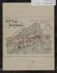
![Davisons [sic] map 25 miles around Minneapolis : 1881 corrected to 1884](https://geo.btaa.org/rails/active_storage/representations/redirect/eyJfcmFpbHMiOnsibWVzc2FnZSI6IkJBaHBBbDF5IiwiZXhwIjpudWxsLCJwdXIiOiJibG9iX2lkIn19--e2a371359b0a0b478005b350887b5a48c3690be0/eyJfcmFpbHMiOnsibWVzc2FnZSI6IkJBaDdCem9MWm05eWJXRjBTU0lKYW5CbFp3WTZCa1ZVT2hKeVpYTnBlbVZmZEc5ZlptbDBXd2RwQWNndyIsImV4cCI6bnVsbCwicHVyIjoidmFyaWF0aW9uIn19--fb19b03b9eb4e78013d4cfb2b84169f3537e0279/p16022coll245-869.jpeg)
![Davisons [sic] map 25 miles around the Twin Cities : 1881 corrected to 1889](https://geo.btaa.org/rails/active_storage/representations/redirect/eyJfcmFpbHMiOnsibWVzc2FnZSI6IkJBaHBBbDV5IiwiZXhwIjpudWxsLCJwdXIiOiJibG9iX2lkIn19--1cfa66af7e0468ba51cd76e61726920357368cc6/eyJfcmFpbHMiOnsibWVzc2FnZSI6IkJBaDdCem9MWm05eWJXRjBTU0lKYW5CbFp3WTZCa1ZVT2hKeVpYTnBlbVZmZEc5ZlptbDBXd2RwQWNndyIsImV4cCI6bnVsbCwicHVyIjoidmFyaWF0aW9uIn19--fb19b03b9eb4e78013d4cfb2b84169f3537e0279/p16022coll245-896.jpeg)
![Generalized Land Use 2000 [Minnesota]](https://geo.btaa.org/rails/active_storage/representations/redirect/eyJfcmFpbHMiOnsibWVzc2FnZSI6IkJBaHBBbG1MIiwiZXhwIjpudWxsLCJwdXIiOiJibG9iX2lkIn19--866bf99b41fee6265daf86e4e9e96ac67684969b/eyJfcmFpbHMiOnsibWVzc2FnZSI6IkJBaDdCem9MWm05eWJXRjBTU0lKYW5CbFp3WTZCa1ZVT2hKeVpYTnBlbVZmZEc5ZlptbDBXd2RwQWNndyIsImV4cCI6bnVsbCwicHVyIjoidmFyaWF0aW9uIn19--fb19b03b9eb4e78013d4cfb2b84169f3537e0279/8aac47fc-7f1a-4ab5-ac8b-3659e970c3d8.jpeg)
![Generalized Land Use 2005 [Minnesota]](https://geo.btaa.org/rails/active_storage/representations/redirect/eyJfcmFpbHMiOnsibWVzc2FnZSI6IkJBaHBBbHFMIiwiZXhwIjpudWxsLCJwdXIiOiJibG9iX2lkIn19--c8756a9879899490adab298de6e8279f733552fc/eyJfcmFpbHMiOnsibWVzc2FnZSI6IkJBaDdCem9MWm05eWJXRjBTU0lKYW5CbFp3WTZCa1ZVT2hKeVpYTnBlbVZmZEc5ZlptbDBXd2RwQWNndyIsImV4cCI6bnVsbCwicHVyIjoidmFyaWF0aW9uIn19--fb19b03b9eb4e78013d4cfb2b84169f3537e0279/8eb314dc-9a4e-4d8c-999e-6fdcf401c663.jpeg)
![Generalized Land Use 2010 [Minnesota]](https://geo.btaa.org/rails/active_storage/representations/redirect/eyJfcmFpbHMiOnsibWVzc2FnZSI6IkJBaHBBbHVMIiwiZXhwIjpudWxsLCJwdXIiOiJibG9iX2lkIn19--dde841b25d7e88886ab0f21dcc33df1ff5701cf9/eyJfcmFpbHMiOnsibWVzc2FnZSI6IkJBaDdCem9MWm05eWJXRjBTU0lKYW5CbFp3WTZCa1ZVT2hKeVpYTnBlbVZmZEc5ZlptbDBXd2RwQWNndyIsImV4cCI6bnVsbCwicHVyIjoidmFyaWF0aW9uIn19--fb19b03b9eb4e78013d4cfb2b84169f3537e0279/5c531877-7ab8-4a03-8080-6c59440561d1.jpeg)
![Generalized Land Use 2016 [Minnesota]](https://geo.btaa.org/rails/active_storage/representations/redirect/eyJfcmFpbHMiOnsibWVzc2FnZSI6IkJBaHBBbHlMIiwiZXhwIjpudWxsLCJwdXIiOiJibG9iX2lkIn19--63535dcb501ef0b3153d1fe1b48b8f5cf2a86bdd/eyJfcmFpbHMiOnsibWVzc2FnZSI6IkJBaDdCem9MWm05eWJXRjBTU0lKYW5CbFp3WTZCa1ZVT2hKeVpYTnBlbVZmZEc5ZlptbDBXd2RwQWNndyIsImV4cCI6bnVsbCwicHVyIjoidmFyaWF0aW9uIn19--fb19b03b9eb4e78013d4cfb2b84169f3537e0279/249d522a-1f68-4714-8160-a8948df939f6.jpeg)
![Generalized Land Use Historical (1984, 1990, 1997, 2000, 2005, 2010, 2016, 2020) [Minnesota]](https://geo.btaa.org/rails/active_storage/representations/redirect/eyJfcmFpbHMiOnsibWVzc2FnZSI6IkJBaHBBbGlMIiwiZXhwIjpudWxsLCJwdXIiOiJibG9iX2lkIn19--c071cbdf309246cc37e9d4f13f25352e274c33b9/eyJfcmFpbHMiOnsibWVzc2FnZSI6IkJBaDdCem9MWm05eWJXRjBTU0lKYW5CbFp3WTZCa1ZVT2hKeVpYTnBlbVZmZEc5ZlptbDBXd2RwQWNndyIsImV4cCI6bnVsbCwicHVyIjoidmFyaWF0aW9uIn19--fb19b03b9eb4e78013d4cfb2b84169f3537e0279/15a50230-0245-41ae-b6fd-fbb2ebc06ba7.jpeg)