1. Major Empires
31 B.C - 1949. U-Spatial (University of Minnesota). Greatest extents of the British, Mongol, and Roman Empires during their territorial peaks. The spatial extent of each empire represents the territo...
31 B.C - 1949. U-Spatial (University of Minnesota). Greatest extents of the British, Mongol, and Roman Empires during their territorial peaks. The spatial extent of each empire represents the territo...
between 1100 and 1400. Jerusalem--Maps.
1482. Ptolemy, active 2nd century. Spain--Maps--Early works to 1800--Facsimiles.
1490. Ptolemy, active 2nd century. Scale not given; 1 map: color; sheet 36 x 50 cm World maps--Early works to 1800--Facsimiles. Carlos Sanz.
between 1492 and 1493. Raisz, Erwin, 1893-1968. Columbus, Christopher--Travel--Maps.
1500. Relief shown pictorially.; Shows borders.; "Publised by James Wyld (successor to Mr. Faden) Geographer to His Majesty. Charing Cross. East. 1833." ... publisher location not identified (publisher not identified).
Early Modern Period and 1500-1800. Benito-Vessels, Carmen. This interactive guide intends to accompany Carmen Benito-Vessels’ research (https://www.anle.us/publicaciones/biblioteca-digital/espana-y-la-cost...
1502. France. Comité des travaux historiques et scientifiques and Mappemonde Portugaise anonyme de 1502. Trs lgrement rduite. From Bulletin de geographie historique et descriptive, v. 1, 1886. Map is opp. p. 382. Discussion of map, p. 147-160. 1 map; 8...
1521. Magalhães, Fernão de, -1521--Maps--Facsimiles.
1538. Mercator, Gerhard, 1512-1594. Scale not given; 1 map in 2 sections; on sheet 35 cm World maps--Early works to 1800--Facsimiles. Carlos Sanz.
1540. Münster, Sebastian, 1489-1552 and Ptolemy, active 2nd century. Cartographic Details: Scale not given. Relief shown pictorially. Appears in Ptolemy's Geographia universalis, 1540 edition, revised & edition by Se... Apud Henricum Petrum; Basiliae.
![[Europe as a woman].](https://geo.btaa.org/rails/active_storage/representations/redirect/eyJfcmFpbHMiOnsibWVzc2FnZSI6IkJBaHBBdHhmIiwiZXhwIjpudWxsLCJwdXIiOiJibG9iX2lkIn19--ee8b9003e42e41a34a3683af01f01f0008347bad/eyJfcmFpbHMiOnsibWVzc2FnZSI6IkJBaDdCem9MWm05eWJXRjBTU0lKYW5CbFp3WTZCa1ZVT2hKeVpYTnBlbVZmZEc5ZlptbDBXd2RwQWNndyIsImV4cCI6bnVsbCwicHVyIjoidmFyaWF0aW9uIn19--fb19b03b9eb4e78013d4cfb2b84169f3537e0279/a222b3ef-8d0b-4d77-85b0-65bfc23b5369.jpeg)
1550. Putsch, Johann. Map of Europe in the form of a woman, with her head facing Africa and labled as Hispania and the bottom of the woman's dress labled as Greece, Bulg...
1560-1570. Agas, Ralph, 1545-1621. Relief shown pictorially. Bird's-eye-view. Includes ill., text and coats-of-arms. 1 view on 8 sheets; 70 x 182 cm, sheets 59 x 44 cm and 44 x 59 cm.
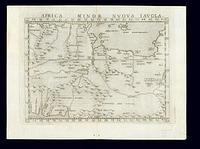
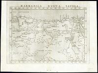
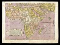
1561. Ptolemy, active 2nd century and Ruscelli, Girolamo, -approximately 1565. 1 map; 18 x 25 cm Scale approximately 1:21,000,000 ; Relief shown pictorially ; Map covers North and West Africa ; Place names in Latin and Italian... Appresso Vincenzo Valgrisi.
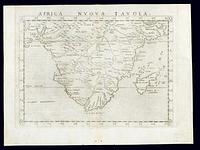
1561. Ptolemy, active 2nd century and Ruscelli, Girolamo, -approximately 1565. 1 map; 18 x 25 cm Scale approximately 1:35,000,000 ; Relief shown pictorially. ; Map covers Africa south of 10°N latitude ; Place names in Latin an... Appresso Vincenzo Valgrisi.
1561. Ptolemy, active 2nd century and Ruscelli, Girolamo, -approximately 1565. 1 map; 18 x 25 cm Scale approximately 1:3,000,000 ; Relief shown pictorially ; Place names in Latin and Italian. Text on verso in Italian ; Detache... Appresso Vincenzo Valgrisi.
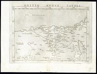
1561. Ptolemy, active 2nd century and Ruscelli, Girolamo, -approximately 1565. 1 map; 18 x 25 cm Scale approximately 1:22,000,000 ; Relief shown pictorially ; Map covers Egypt and Northeast Africa ; Place names in Latin and It... Appresso Vincenzo Valgrisi.
1561. Ptolemy, active 2nd century and Ruscelli, Girolamo, -approximately 1565. 1 map; 18 x 24 cm Scale approximately 1:26,000,000 ; Relief shown pictorially ; Map covers West Africa and most of North Africa ; Place names in La... Appresso Vincenzo Valgrisi.
1561. Ptolemy, active 2nd century and Ruscelli, Girolamo, -approximately 1565. 1 map; 18 x 25 cm Scale approximately 1:10,000,000 ; Relief shown pictorially ; Map covers Northwest Africa ; Place names in Latin and Italian. Tex... Appresso Vincenzo Valgrisi.
1561. Ptolemy, active 2nd century and Ruscelli, Girolamo, -approximately 1565. 1 map; 18 x 25 cm Scale approximately 1:9,600,000 ; Relief shown pictorially ; Map covers central North Africa ; Place names in Latin and Italian. ... Appresso Vincenzo Valgrisi.
1561. Ptolemy, active 2nd century and Ruscelli, Girolamo, -approximately 1565. 1 map; 18 x 25 cm Scale approximately 1:8,700,000. ; Relief shown pictorially ; Map covers Egypt and Northeast Africa ; Place names in Latin and It... Appresso Vincenzo Valgrisi.
1562. Forlani, Paolo. 1 map : hand colored; 44 x 60 cm Paulo Forlani, Veronese ; Scale approximately 1:20,000,000 ; Relief shown pictorially ; Dedication to Thomaso Rave... Publisher not identified.
1562. Gastaldi, Giacomo, approximately 1500-approximately 1565. Relief shown pictorially. "Con gratia et priuilegio del sumo po[n]tifice papa pio iiij per anni x e del sere.mo senato di Vene[ti]a p[er] anni xv.". [Venezia : s.n.], 1562.
1562. Gastaldi, Giacomo, approximately 1500-approximately 1565. Relief shown pictorially. "Con gratia et priuilegio del sumo po[n]tifice papa pio iiij per anni x e del sere.mo senato di Vene[ti]a p[er] anni xv.". [Venezia : s.n.], 1562.
1562. Gastaldi, Giacomo, approximately 1500-approximately 1565. Relief shown pictorially. "Con gratia et priuilegio del sumo po[n]tifice papa pio iiij per anni x e del sere.mo senato di Vene[ti]a p[er] anni xv.". [Venezia : s.n.], 1562.
1564. Le Moyne de Morgues, Jacques, 1533?-1588. To accompany Le Moyne's narrative 979 F6L. Reproduction, probably late 19th cent. 1 map; 37 x 46 cm.
1564. Not drawn to scale; 1 view; 10 x 12 cm, on sheet 22 x 14 cm Fort Caroline National Memorial (Jacksonville, Fla.)--Aerial views.
1570?. Ortelius, Abraham, 1527-1598. Relief shown pictorially. On verso: Text and plate number "2." Appeared as pl. 2 in his Theatrum orbis terrarum. Antwerp, 1570. Decorative cartouch...
1570. Ortelius, Abraham, 1527-1598. 1 map: hand colored; Relief shown pictorially; (In Ortel (Abraham). Theatrum orbis terrarum. fol. Antiverpiæ, apud Ægid Coppenium Diesth, 1570); Cu... Abraham Ortelius.
1570. Ortelius, Abraham, 1527-1598. 1 map: hand colored; Relief shown pictorially; (In Ortel (Abraham). Theatrum orbis terrarum. fol. Antiverpiæ, apud Ægid Coppenium Diesth, 1570); Cu...
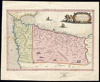
1570 to 1612?. 1 map : hand colored; 33 x 48 cm Scale approximately 1:780,000 ; (W 4°46'-- W 3°04'/N 53°42'-- N 52°25'). ; Relief shown pictorially.; Includes ill... [Henricus Hondius & Johannes Janssonius].
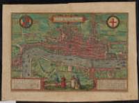
1572. Braun, Georg, 1540 or 1541-1622. From: Braun & Hogenberg's Civitates orbis terrarum, 1572.; Hand colored view of the city of London showing sites along the Thames River including a... Braun & Hogenberg (Cologne).
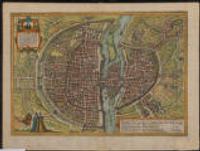
1572. Braun, Georg, 1540 or 1541-1622. Note at lower right corner.; Printed on verso: "8." 25 x 49 centimeters, on sheet 42 x 54 centimeters Not drawn to scale City Maps. Bey Godfrid von Kempen in verlegung Francisci Hogenbergers (Co?lln).
1572. Münster, Sebastian, 1489-1552. Cartographic Details: Scale not given. (E 79°22'00"--E 82°04'00"/N 10°02'00"--N 5°43'00") Relief shown pictorially. Likely from Cosmographiae Unive...
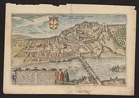
1573 to 1620?. Braun, Georg, 1540 or 1541-1622. 1 view : hand colored; 28 x 45 cm Scale not given (W 008°25ʹ10ʺ/N 40°12ʹ20ʺ) ; Relief shown pictorially.; Possibly derived from original drawing by... [publisher not identified].
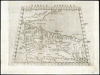
circa 1578. Ptolemy, active 2nd century and Mercator, Gerhard, 1512-1594. 1 map : hand colored; 32 x 46 cm Scale approximately 1:4,930,000 ; Title across top: Africæ I. Tab: ; Based on Ptolemy's Geography ; Relief shown p... Publisher not identified.
1579. Ortelius, Abraham, 1527-1598. A part of Terra Australis Incognita shown south of Nova Guinea. 36 x 49 centimeters Scale approximately 1:24,000,000 Ames Library of South Asia Maps.
1579. Ortelius, Abraham, 1527-1598. Oval map within illustrated border, showing clouds.; Appears in Latin edition of Ortelius's Theatrum orbis terrarum.; Hand colored.; Includes illus... Abraham Ortelius (Antwerp).
1584. 1 map; 30 x 44 cm Scale approximately 1:1,700,000 (W 29°10ʹ--W 22°20ʹ/N 36°30ʹ--N 41°12ʹ) ; Relief shown pictorially.; 'Longitudo huius description... [publisher not identified].
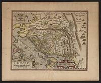
1584. Barbuda, Luis Jorge de, fl. 1575-1599 and Ortelius, Abraham, 1527-1598. Relief shown pictorially. Oriented with north to the right. Includes ill. and decorative cartouches. On verso: La China, p. 118. From Ortellius' Th...
1584. Grodecki, Wacław, 1535?-1591, Ortelius, Abraham, 1527-1598, and Plantin, Christophe, approximately 1520-1589. This layer is a georeferenced raster image of the historic paper map entitled: Poloniae finitimarumque locorum descriptio. It was published by: Auc... Harvard Map Collection, Harvard Library.
1584. Dahl, James, former owner, Ortelius, Abraham, 1527-1598, and Plantin, Christophe, approximately 1520-1589, printer. This is map no. 92 of the author's Theatrvm orbis terrarvm. Antwerpiae, 1584. Cf. U.S. Library of Congress. Division of Maps. A list of geographica...
1588. Münster, Sebastian, 1489-1552. Oval map within illustrated border.; Appears in Sebastian Münster's Cosmografia (published circa 1588).; Prime meridian: Ferro.; Includes text.; Te... Sebastian Henricpetri (Basel).
1590. Map showing Virginia and surrounding areas, 1590. First map to show and name the Chesapeake Bay. 31 x 42 cm; 1 images; color. White, John and Theodor de Bry.
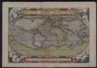
1590. Hogenberg, Frans, approximately 1539-1590. 1 map: color; Hand col; "Cum privilegio." Scale approximately 1:81,800,000 (W 180°--E 180°/N 90°--S 90°).
1592. Ortelius, Abraham, 1527-1598. Relief shown pictorially.; Includes title in cartouche, coat of arms and illustrations of ships, mermaids, and sea monsters.; Includes southwest se... (Antwerp).
1593. Jode, Gerard de, approximately 1516 or 1517-1591. 1 map; 32 x 45 cm Gerard de Jode ; Scale approximately 1:28,000,000 ; Relief shown pictorially ; Text on verso ; Antwerp : Formis Hæredum Gerardi d... Formis Hæredum Gerardi de Jode.
1595. Mercator, Gerard, approximately 1565-1656 and Mercator, Gerhard, 1512-1594. 1 map : hand colored; 38 x 47 cm Gerhard Mercator ; Scale approximately 1:26,000,000 ; Relief shown pictorially ; 'Cum previlegio.' ; Verso pages n... Publisher not identified.
approximately 1595. Mercator, Michael. 1 map: color; (In Mercator (Gerhard). Atlas. Ed. 10° (11th ed.) fol. Amsterodami, sumptibus H. Hondij, 1630); Insets: Golfo Mexi Cano; Haiti nunc H...
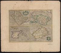
1595?. 4 maps on one sheet hand colored; 15 x 20 cm and 15 x 21 cm on sheet 51 x 59 cm Scales differ. ; Per Gerardum Mercatorem, cum privilegio; Text in L... [publisher not identified].