Search

You searched for: land use minneapolis Remove constraint land use minneapolis

Search Results

1. Historic County Boundaries and Total Population: United States, 1800

Datasets

1800. University of Minnesota. Minnesota Population Center. This boundary file contains historic county boundaries for which the U.S. Census Bureau tabulated data and was produced by the Minnesota Population... National Historical Geographic Information System (NHGIS).
2. Historic County Boundaries and Total Population: United States, 1810

Datasets

1810. University of Minnesota. Minnesota Population Center. This boundary file contains historic county boundaries for which the U.S. Census Bureau tabulated data and was produced by the Minnesota Population... National Historical Geographic Information System (NHGIS).
3. Historic County Boundaries and Total Population: United States, 1820

Datasets

1820. University of Minnesota. Minnesota Population Center. This boundary file contains historic county boundaries for which the U.S. Census Bureau tabulated data and was produced by the Minnesota Population... National Historical Geographic Information System (NHGIS).
4. Historic County Boundaries and Total Population: United States, 1830

Datasets

1830. University of Minnesota. Minnesota Population Center. This boundary file contains historic county boundaries for which the U.S. Census Bureau tabulated data and was produced by the Minnesota Population... National Historical Geographic Information System (NHGIS).
5. Historic County Boundaries and Total Population: United States, 1840

Datasets

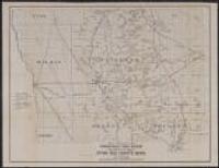
1840. University of Minnesota. Minnesota Population Center. This boundary file contains historic county boundaries for which the U.S. Census Bureau tabulated data and was produced by the Minnesota Population... National Historical Geographic Information System (NHGIS).

7. Historic County Boundaries and Total Population: United States, 1850

Datasets

1850. University of Minnesota. Minnesota Population Center. This boundary file contains historic county boundaries for which the U.S. Census Bureau tabulated data and was produced by the Minnesota Population... National Historical Geographic Information System (NHGIS).

8. Historic County Boundaries and Total Population: United States, 1860

Datasets

1860. University of Minnesota. Minnesota Population Center. This boundary file contains historic county boundaries for which the U.S. Census Bureau tabulated data and was produced by the Minnesota Population... National Historical Geographic Information System (NHGIS).

9. Historic County Boundaries and Total Population: United States, 1870

Datasets

1870. University of Minnesota. Minnesota Population Center. This boundary file contains historic county boundaries for which the U.S. Census Bureau tabulated data and was produced by the Minnesota Population... National Historical Geographic Information System (NHGIS).

12. Digital Sanborn Maps (Black & White): Kansas, 1867-1970

Maps

Between 1880 and 1950. Sanborn Map Company. Digital Sanborn® Maps (1867-1970) delivers detailed property and land-use records that depict the grid of everyday life in more than 12,000 U.S. to... ProQuest Information and Learning Company.

13. Digital Sanborn Maps (Black & White): Minnesota, 1867-1970

Maps

Between 1880 and 1950. Sanborn Map Company. Digital Sanborn® Maps (1867-1970) delivers detailed property and land-use records that depict the grid of everyday life in more than 12,000 U.S. to... ProQuest Information and Learning Company.

14. Fire Insurance Maps Online (FIMo): Kansas

Maps

Between 1880 and 1955. Provides access to a digital collection of historical color fire insurance maps, real estate atlases, and similar land use maps for North America. ... Historical Information Gatherers, Inc.

15. Fire Insurance Maps Online (FIMo): Minnesota

Maps

Between 1880 and 1955. Provides access to a digital collection of historical color fire insurance maps, real estate atlases, and similar land use maps for North America. ... Historical Information Gatherers, Inc.

16. Historic County Boundaries and Total Population: United States, 1880

Datasets

1880. University of Minnesota. Minnesota Population Center. This boundary file contains historic county boundaries for which the U.S. Census Bureau tabulated data and was produced by the Minnesota Population... National Historical Geographic Information System (NHGIS).

17. Map of Stearns County, Minnesota

Map of Stearns County, Minnesota

1880. Bourquin, Frederick, 1808-, Bracher, William, and Warner & Foote. Cartographic Details: Scale approximately 1:57,000. Facsimile: location of original and date of reproduction unknown. Scale of original [1:45,258],... Warner & Foote (Minneapolis, Minnesota), 1880.

19. Davisons [sic] map 25 miles around Minneapolis : 1881 corrected to 1884

Davisons [sic] map 25 miles around Minneapolis : 1881 corrected to 1884

1884. Cooley, George Washington (1845-1920). Shows metropolitan area of both Minneapolis and Saint Paul. Also shows railroad lines, roads, Public Land Survey townships and sections, cemeteries... C. Wright Davison. Lith. By Johnson, Smith & Harrison (Minneapolis, Minn.), 1881.