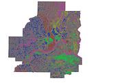
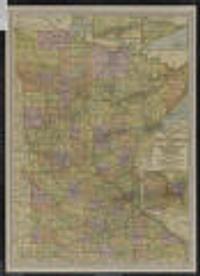
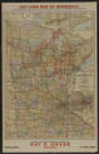
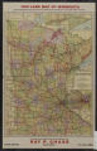
Search

You searched for: land use minneapolis Remove constraint land use minneapolis

Search Results

5. Land Surface Temperature 2022, Twin Cities [Minnesota]

Datasets

2022-09-01. Metropolitan Council of the Twin Cities Area. High resolution (10 meter) land surface temperature (LST) from September 1, 2022 is mapped for the seven-county metropolitan region of the Twin Cit...

6. Land Surface Temperature 2016, Twin Cities [Minnesota]

Datasets

2016-07-22. Metropolitan Council of the Twin Cities Area. The Land Surface Temperature (LST) raster dataset is a dataset derived from a satellite image from Landsat 8 to show the land surface temperature f...

7. Planning Zoning Built Form [Minnesota--Minneapolis]

Datasets

Continually updated resource. MapIT Minneapolis. Built form - this column is the name of the built form district Abbrv - this column is the abbreviation of the name of the district Built form dist...

9. Transit Stations [Minnesota--Minneapolis]

Datasets

Continually updated resource. MapIT Minneapolis. For questions about this data please contactCPEDOpenData@minneapolismn.govDesignated land use features from the City's adopted comprehensive plan.

10. Public 311 [Minnesota--Minneapolis] {2020}

Datasets

2020. MapIT Minneapolis. For questions about this data please contact311OpenData@minneapolismn.govThe data provided are public-facing service requests that were taken by 31...

11. Public 311 [Minnesota--Minneapolis] {2015}

Datasets

2015. MapIT Minneapolis. For questions about this data please contact311OpenData@minneapolismn.govThe data provided are public-facing service requests that were taken by 31...

12. Public 311 [Minnesota--Minneapolis] {2019}

Datasets

2019. MapIT Minneapolis. For questions about this data please contact311OpenData@minneapolismn.gov The data provided are public-facing service requests that were taken by 3...

13. Public 311 [Minnesota--Minneapolis] {2018}

Datasets

2018. MapIT Minneapolis. For questions about this data please contact311OpenData@minneapolismn.gov The data provided are public-facing service requests that were taken by 3...

14. Public 311 [Minnesota--Minneapolis] {2016}

Datasets

2016. MapIT Minneapolis. For questions about this data please contact311OpenData@minneapolismn.gov The data provided are public-facing service requests that were taken by 3...

15. Public 311 [Minnesota--Minneapolis] {2017}

Datasets

2017. MapIT Minneapolis. For questions about this data please contact311OpenData@minneapolismn.gov The data provided are public-facing service requests that were taken by 3...

17. Goods and Services Corridor [Minnesota--Minneapolis]

Datasets

Continually updated resource. MapIT Minneapolis. For questions about this data please contactCPEDOpenData@minneapolismn.govGoods and Services Corridors serve two purposes within the Minneapolis 20...

18. CCS Permits [Minnesota--Minneapolis]

Datasets

Continually updated resource. MapIT Minneapolis. Display - This is the address of the property, the permit was issued for APN - The Assessor's Parcel Number (APN) is a unique number assigned by th...

20. Generalized Land Use 2020 [Minnesota]

Datasets

2020-04-10. Metropolitan Council of the Twin Cities Area. The 2020 Generalized Land Use Inventory dataset encompasses the seven county Twin Cities (Minneapolis and St. Paul) Metropolitan Area in Minnesota....

21. Map of Ashland County and portion of Bayfield Co., Wisconsin

Map of Ashland County and portion of Bayfield Co., Wisconsin

1915-1925?. Shows locations of school houses, churches, farms, and Bad River Indian Reservation; also shows Soo Line railroad and part of Chequamegon Bay.; "La... Minneapolis, St. Paul and Sault Ste. Marie Railway Co (Minneapolis, Minn).

23. Map of Iron County, Wisconsin

Map of Iron County, Wisconsin

1910-1919?. Minneapolis, St. Paul & Sault Ste. Marie Railway Company. Shows land for sale by the Soo Line, town sections, schools, churches, and farms.; "For particular information ... address W.H. Killen, land and in... Minneapolis, St. Paul & Sault Ste. Marie Railway Co (Minneapolis, Minn).

24. Map of Minnesota

Map of Minnesota

1925-1926. Chase, Ray P. (Ray Park), 1880-1948. State lands for sale in 1926 indicated in red.; "In each township marked with a red dot the state is offering for sale, at public auction, various ... McGill-Warner Co (St. Paul, Minn), 1925.

25. Gun Flint Iron Range

Gun Flint Iron Range

1900. Diamond Litho-Pubg. Co. Shows portions of Lake and Cook Counties, Minnesota and indicates land of the American Realty Co.; Includes text in upper and lower margins, and ta... Diamond Litho-Pubg. Co (Minneapolis, [Minn).

26. Map of Minnesota : state lands

Map of Minnesota : state lands

1928. McGill-Warner Co. State lands for sale in 1929 indicated in red.; In each township with a red dot, the state is offering, at public auction, various tracts of state-... McGill-Warner (St. Paul), 1928.

27. Map of Minnesota : the land of opportunities

Map of Minnesota : the land of opportunities

1925. Minnesota State Board of Immigration. Title from outside when folded.; Insets: Mesabi Range.--Cook County, northeastern Minnesota.--St. Paul-Minneapolis and vicinity.; Inset photos on v... Minnesota State Board of Immigration : (St. Paul), 1925.

28. Map of Minnesota : state lands

Map of Minnesota : state lands

1925. McGill-Warner Co. State lands for sale in 1927 indicated in red.; In each township with a red dot, the state is offering, at public auction, various tracts of state-... McGill-Warner (St. Paul), 1925.

29. Map of Minnesota : state lands

Map of Minnesota : state lands

1925. McGill-Warner Co. State lands for sale in 1925 indicated in red.; In each township with a red dot, the state is offering, at public auction, various tracts of state-... McGill-Warner (St. Paul), 1925.

31. Use district map

Use district map

1924. Minneapolis (Minn.). City Planning Commission. Shows districts by type of use. Prime meridian: Greenwich.; Verso: Wisconsin automobile road map.; "140D" in lower right. on sheet 55 x 43 centimet... City Planning Commission (Minneapolis, Minn).

32. [Lake Minnetonka]

[Lake Minnetonka]

1903. Shows land owners.; Probably removed from: Minneapolis Real Estate Board. Atlas of Minneapolis, Hennepin County, Minnesota. Minneapolis: 1903. 32 x... (Minneapolis], ).

36. Digital Sanborn Maps (Black & White): Minnesota, 1867-1970

Maps

Between 1880 and 1950. Sanborn Map Company. Digital Sanborn® Maps (1867-1970) delivers detailed property and land-use records that depict the grid of everyday life in more than 12,000 U.S. to... ProQuest Information and Learning Company.

37. Digital Sanborn Maps (Black & White): Kansas, 1867-1970

Maps

Between 1880 and 1950. Sanborn Map Company. Digital Sanborn® Maps (1867-1970) delivers detailed property and land-use records that depict the grid of everyday life in more than 12,000 U.S. to... ProQuest Information and Learning Company.

38. Fire Insurance Maps Online (FIMo): Minnesota

Maps

Between 1880 and 1955. Provides access to a digital collection of historical color fire insurance maps, real estate atlases, and similar land use maps for North America. ... Historical Information Gatherers, Inc.

39. Fire Insurance Maps Online (FIMo): Kansas

Maps

Between 1880 and 1955. Provides access to a digital collection of historical color fire insurance maps, real estate atlases, and similar land use maps for North America. ... Historical Information Gatherers, Inc.

40. Historic County Boundaries and Total Population: United States, 1890

Datasets

1890. University of Minnesota. Minnesota Population Center. This boundary file contains historic county boundaries for which the U.S. Census Bureau tabulated data and was produced by the Minnesota Population... National Historical Geographic Information System (NHGIS).

41. Historic County Boundaries and Total Population: United States, 1840

Datasets

1840. University of Minnesota. Minnesota Population Center. This boundary file contains historic county boundaries for which the U.S. Census Bureau tabulated data and was produced by the Minnesota Population... National Historical Geographic Information System (NHGIS).

42. Historic County Boundaries and Total Population: United States, 1870

Datasets

1870. University of Minnesota. Minnesota Population Center. This boundary file contains historic county boundaries for which the U.S. Census Bureau tabulated data and was produced by the Minnesota Population... National Historical Geographic Information System (NHGIS).

43. Historic County Boundaries and Total Population: United States, 1850

Datasets

1850. University of Minnesota. Minnesota Population Center. This boundary file contains historic county boundaries for which the U.S. Census Bureau tabulated data and was produced by the Minnesota Population... National Historical Geographic Information System (NHGIS).

44. Historic County Boundaries and Total Population: United States, 1860

Datasets

1860. University of Minnesota. Minnesota Population Center. This boundary file contains historic county boundaries for which the U.S. Census Bureau tabulated data and was produced by the Minnesota Population... National Historical Geographic Information System (NHGIS).

45. Historic County Boundaries and Total Population: United States, 1880

Datasets

1880. University of Minnesota. Minnesota Population Center. This boundary file contains historic county boundaries for which the U.S. Census Bureau tabulated data and was produced by the Minnesota Population... National Historical Geographic Information System (NHGIS).

46. Historic County Boundaries and Total Population: United States, 1980

Datasets

1980. University of Minnesota. Minnesota Population Center. This boundary file contains historic county boundaries for which the U.S. Census Bureau tabulated data and was produced by the Minnesota Population... National Historical Geographic Information System (NHGIS).

47. Historic County Boundaries and Total Population: United States, 1910

Datasets

1910. University of Minnesota. Minnesota Population Center. This boundary file contains historic county boundaries for which the U.S. Census Bureau tabulated data and was produced by the Minnesota Population... National Historical Geographic Information System (NHGIS).

48. Historic County Boundaries and Total Population: United States, 1920

Datasets

1920. University of Minnesota. Minnesota Population Center. This boundary file contains historic county boundaries for which the U.S. Census Bureau tabulated data and was produced by the Minnesota Population... National Historical Geographic Information System (NHGIS).

49. Historic County Boundaries and Total Population: United States, 1960

Datasets

1960. University of Minnesota. Minnesota Population Center. This boundary file contains historic county boundaries for which the U.S. Census Bureau tabulated data and was produced by the Minnesota Population... National Historical Geographic Information System (NHGIS).

50. Historic County Boundaries and Total Population: United States, 1900

Datasets

1900. University of Minnesota. Minnesota Population Center. This boundary file contains historic county boundaries for which the U.S. Census Bureau tabulated data and was produced by the Minnesota Population... National Historical Geographic Information System (NHGIS).