Datasets > Image data > Wisconsin > 1800-1849
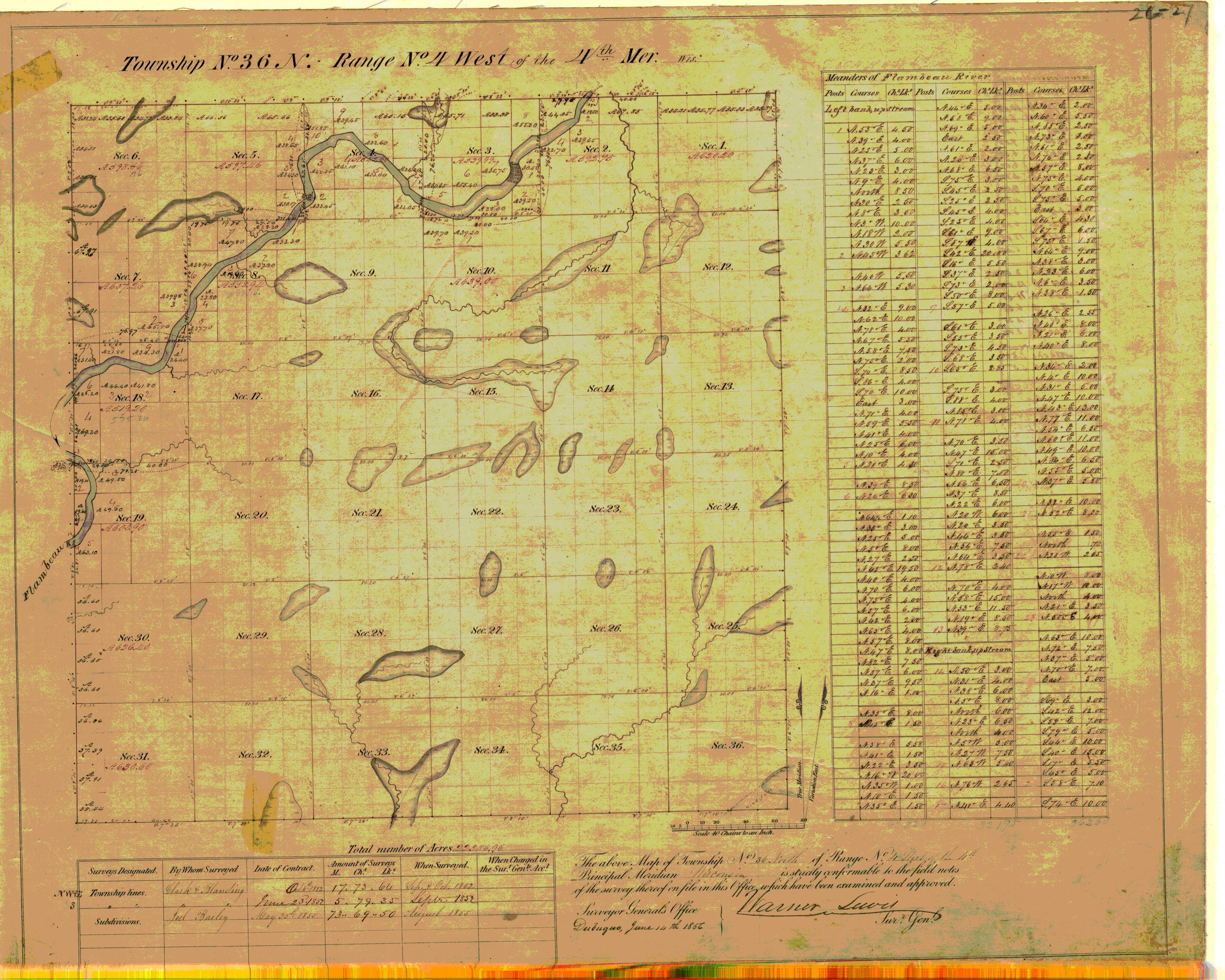
Original PLSS Plat Map: WI T36N, R04W
United States General Land Office · 1832 Full Details
Danger: This record was retired in 2026 and replaced.
Full Details
- Title
- Original PLSS Plat Map: WI T36N, R04W
- Description
- The field notes and plat maps of the public land survey of Wisconsin are a valuable resource for original land survey information, as well as for understanding Wisconsin's landscape history. The survey of Wisconsin was conducted between 1832 and 1866 by the federal General Land Office. This work established the township, range and section grid; the pattern upon which land ownership and land use is based. The survey records were transferred to the Wisconsin Board of Commissioners of Public Lands (BCPL) after the original survey was completed. Since that time, these records have been available for consultation at the BCPL's office in Madison, as hand-transcriptions, and more recently on microfilm. Now, they are being made available via the internet as electronic images.
- Creator
- United States General Land Office
- Subject
- Planning and Cadastral
- Temporal Coverage
- 1832-1866
- Access Rights
- Public
- Format
- TIFF
- Language
- English
- Date Added
- April 26, 2021
Resource Class
Resource Type
Theme
Place
Provider
Local Collection
Location
Links
Cite and Reference
-
Citation
United States General Land Office (n.d.). Original PLSS Plat Map: WI T36N, R04W. . https://search.library.wisc.edu/digital/ANNQPECJDNAVEC8W (dataset) -
BTAA Geoportal Link
