1. ArcGIS Living Atlas of the World

Living Atlas is a centralized platform where Esri offers authoritative, curated, and ready-to-use content can be utilized by the GIS community. Esri.
Living Atlas is a centralized platform where Esri offers authoritative, curated, and ready-to-use content can be utilized by the GIS community. Esri.

2000-present. Data.census.gov is the centralized platform to access data and digital content from the U.S. Census Bureau. U.S. Census Bureau.

2000-present. The Living Atlas collection features census records derived from the U.S. Census Bureau. These datasets are available as geospatial web services an... Esri.
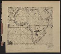
1502. France. Comité des travaux historiques et scientifiques and Mappemonde Portugaise anonyme de 1502. Trs lgrement rduite. From Bulletin de geographie historique et descriptive, v. 1, 1886. Map is opp. p. 382. Discussion of map, p. 147-160. 1 map; 8...
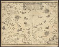
1598. Barentsz, Willem, approximately 1550-1597, Claesz, Cornelis, approximately 1546-1609, and Duetecum, Baptista. 1 map; 42 x 57 cm.
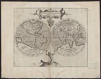
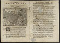
1597?. Wytfliet, Corneille. Relief shown pictorially. From: "Descriptionis Ptolemaicae Augmentum". 1 map; 2 hemispheres each 14 cm. diam., on sheet 30 x 38 cm.
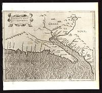
between 1597 and 1634. Bogard, Jean, -approximately 1634, Dahl, James, former owner, and Wytfliet, Corneille. Relief shown pictorially. North oriented to the left of the map. Shows drainage and settlements pictorially. 1 map; 22 x 27 cm.
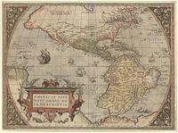
1570?. Ortelius, Abraham, 1527-1598. Relief shown pictorially. On verso: Text and plate number "2." Appeared as pl. 2 in his Theatrum orbis terrarum. Antwerp, 1570. Decorative cartouch...
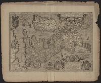
1621. Janssonius van Waesberge, Johannes, active 1642-1681. Relief shown pictorially. Map is oriented with North to the right. Vignette in lower right corner shows three portraits of royalty and two birds wi...
Magini, Giovanni Antonio, 1555-1617. 1 map ; 5 x 7 in. Relief shown pictorially. Signature "Ll iij La". Page number 201 from "Geografia de Cl. Tolomeo.".