1. Antarctica
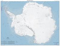
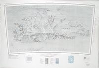
2015. Herried. This map was produced by the Polar Geospatial Center at the University of Minnesota with a generous donation from Lockheed Martin Antarctic Support... Polar Geospatial Center.
2015. Herried. This map was produced by the Polar Geospatial Center at the University of Minnesota with a generous donation from Lockheed Martin Antarctic Support... Polar Geospatial Center.
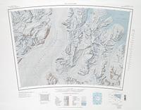
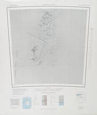
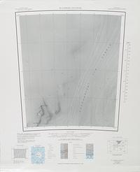
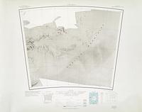
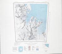
1989. Projection: Polar Stereographic Projection: Standard Parallel -80º14'; Series: USGS 1:250,000 Topographic Reconnaissance Series. United States Geological Survey.
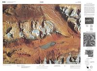
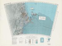
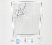
1987. Jean-Claude M. Thomas. Projection: Lambert Conformal Conic Projection - Standard Parallels -76º40' and -79º20'; Series: USGS Satellite Image Maps. United States Geological Survey.
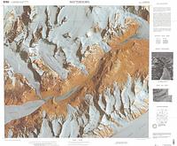
1987. Jean-Claude M. Thomas and Jerry L. Mullins. Projection: Lambert Conformal Conic Projection - Standard Parallels -76º40' and -79º20'; Series: USGS Satellite Image Maps. United States Geological Survey.
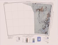
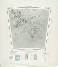
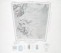
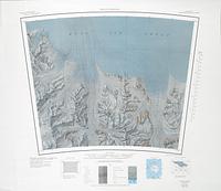
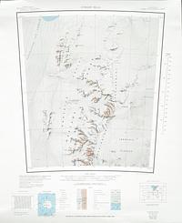
1993. Projection: Lambert Conformal Conic Projection: Standard Parallels -76º40' and -79º20'; Series: USGS 1:50,000 Topographic Series. United States Geological Survey.
1977. Projection: Lambert Conformal Conic Projection: Standard Parallels -76º40' and -79º20'; Series: USGS 1:50,000 Topographic Series. United States Geological Survey.
1997. Projection: Lambert Conformal Conic Projection: Standard Parallels -76º40' and -79º20'; Series: USGS 1:50,000 Topographic Series. United States Geological Survey.
1997. Projection: Lambert Conformal Conic Projection: Standard Parallels -76º40' and -79º20'; Series: USGS 1:50,000 Topographic Series. United States Geological Survey.
1987. Series: USGS Satellite Image Maps. United States Geological Survey.
1974. Series: USGS Satellite Image Maps. United States Geological Survey.
1974. Series: USGS Satellite Image Maps. United States Geological Survey.
2009. Series: USGS Satellite Image Maps. United States Geological Survey.
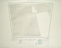
1967. Projection: Polar Stereographic Projection: Standard Parallel -80º14'; Series: USGS 1:250,000 Topographic Reconnaissance Series. United States Geological Survey.
1968. Projection: Polar Stereographic Projection: Standard Parallel -80º14'; Series: USGS 1:250,000 Topographic Reconnaissance Series. United States Geological Survey.
1989. Projection: Polar Stereographic Projection: Standard Parallel -80º14'; Series: USGS 1:250,000 Topographic Reconnaissance Series. United States Geological Survey.
1968. Projection: Polar Stereographic Projection: Standard Parallel -80º14'; Series: USGS 1:250,000 Topographic Reconnaissance Series. United States Geological Survey.
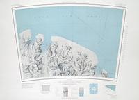
2000. Projection: Lambert Conformal Conic Projection - Standard Parallels -76º40' and -79º20'; Series: USGS Satellite Image Maps. United States Geological Survey.
2001. Projection: Lambert Conformal Conic Projection - Standard Parallels -76º40' and -79º20'; Series: USGS Satellite Image Maps. United States Geological Survey.
1989. Projection: Polar Stereographic Projection: Standard Parallel -80º14'; Series: USGS 1:250,000 Topographic Reconnaissance Series. United States Geological Survey.
1987. Projection: Lambert Conformal Conic Projection - Standard Parallels -76º40' and -79º20'; Series: USGS Satellite Image Maps. United States Geological Survey.
1968. Projection: Polar Stereographic Projection: Standard Parallel -80º14'; Series: USGS 1:250,000 Topographic Reconnaissance Series. United States Geological Survey.
1966. Projection: Polar Stereographic Projection: Standard Parallel -80º14'; Series: USGS 1:250,000 Topographic Reconnaissance Series. United States Geological Survey.
1963. Projection: Polar Stereographic Projection: Standard Parallel -80º14'; Series: USGS 1:250,000 Topographic Reconnaissance Series. United States Geological Survey.
1966. Projection: Polar Stereographic Projection: Standard Parallel -80º14'; Series: USGS 1:250,000 Topographic Reconnaissance Series. United States Geological Survey.
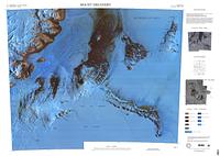
1958. Projection: Polar Stereographic Projection: Standard Parallels 71º; Series: USGS 1:1,000,000 Topographic Miscellaneous Series. United States Geological Survey.
1968. Projection: Polar Stereographic Projection: Standard Parallel -80º14'; Series: USGS 1:250,000 Topographic Reconnaissance Series. United States Geological Survey.
1967. Projection: Polar Stereographic Projection: Standard Parallel -80º14'; Series: USGS 1:250,000 Topographic Reconnaissance Series. United States Geological Survey.
1968. Projection: Polar Stereographic Projection: Standard Parallel -80º14'; Series: USGS 1:250,000 Topographic Reconnaissance Series. United States Geological Survey.
1963. Projection: Polar Stereographic Projection: Standard Parallel -80º14'; Series: USGS 1:250,000 Topographic Reconnaissance Series. United States Geological Survey.
1975. Projection: Lamber Conformal Conic Projection; Series: USGS 1:1,000,000 Topographic Miscellaneous Series. United States Geological Survey.
1963. Projection: Polar Stereographic Projection: Standard Parallel -80º14'; Series: USGS 1:250,000 Topographic Reconnaissance Series. United States Geological Survey.
1989. Projection: Polar Stereographic Projection: Standard Parallel -80º14'; Series: USGS 1:250,000 Topographic Reconnaissance Series. United States Geological Survey.
1996. Projection: Lambert Conformal Conic Projection - Standard Parallels -76º40' and -79º20'; Series: USGS Satellite Image Maps. United States Geological Survey.
1989. Projection: Polar Stereographic Projection: Standard Parallel -80º14'; Series: USGS 1:250,000 Topographic Reconnaissance Series. United States Geological Survey.
1989. Projection: Polar Stereographic Projection: Standard Parallel -80º14'; Series: USGS 1:250,000 Topographic Reconnaissance Series. United States Geological Survey.
1989. Projection: Polar Stereographic Projection: Standard Parallel -80º14'; Series: USGS 1:250,000 Topographic Reconnaissance Series. United States Geological Survey.
1966. Projection: Polar Stereographic Projection: Standard Parallel -80º14'; Series: USGS 1:250,000 Topographic Reconnaissance Series. United States Geological Survey.
1966. Projection: Polar Stereographic Projection: Standard Parallel -80º14'; Series: USGS 1:250,000 Topographic Reconnaissance Series. United States Geological Survey.
1989. Projection: Polar Stereographic Projection: Standard Parallel -80º14'; Series: USGS 1:250,000 Topographic Reconnaissance Series. United States Geological Survey.
1967. Projection: Polar Stereographic Projection: Standard Parallel -80º14'; Series: USGS 1:250,000 Topographic Reconnaissance Series. United States Geological Survey.
1967. Projection: Polar Stereographic Projection: Standard Parallel -80º14'; Series: USGS 1:250,000 Topographic Reconnaissance Series. United States Geological Survey.
1966. Projection: Polar Stereographic Projection: Standard Parallel -80º14'; Series: USGS 1:250,000 Topographic Reconnaissance Series. United States Geological Survey.
1963. Projection: Polar Stereographic Projection: Standard Parallel -80º14'; Series: USGS 1:250,000 Topographic Reconnaissance Series. United States Geological Survey.
1975. Projection: Lambert Conformal Conic Projection - Standard Parallels -76º40' and -79º20'; Series: USGS Satellite Image Maps. United States Geological Survey.
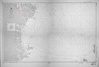
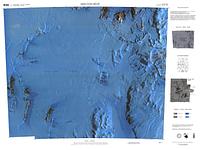
1996. Projection: WGS72 Mercator Projection; Series: Defense Mapping Agency Nautical Charts. National Geospatial-Intelligence Agency.
1989. Projection: Polar Stereographic Projection: Standard Parallel -80º14'; Series: USGS 1:250,000 Topographic Reconnaissance Series. United States Geological Survey.
1989. Projection: Polar Stereographic Projection: Standard Parallel -80º14'; Series: USGS 1:250,000 Topographic Reconnaissance Series. United States Geological Survey.
1967. Projection: Polar Stereographic Projection: Standard Parallel -80º14'; Series: USGS 1:250,000 Topographic Reconnaissance Series. United States Geological Survey.
1984. Projection: Polar Stereographic Projection: Standard Parallel -80º14'; Series: USGS 1:250,000 Topographic Reconnaissance Series. United States Geological Survey.
2000. Projection: Lambert Conformal Conic Projection - Standard Parallels -76º40' and -79º20'; Series: USGS Satellite Image Maps. United States Geological Survey.