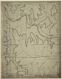
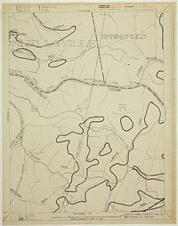
Search

You searched for: Ohio Location Based Response System Remove constraint Ohio Location Based Response System

Search Results

3. LBRS Centerlines [Ohio--Lorain County]

Datasets

Continually updated resource. Lorain County Auditor GIS. *The Location Based Response System (LBRS) is an initiative of the Ohio Geographically Referenced Information Program (OGRIP). The LBRS establishes...

4. LBRS Addresses [Ohio--Lorain County]

Datasets

Continually updated resource. Lorain County Auditor GIS. *The Location Based Response System (LBRS) is an initiative of the Ohio Geographically Referenced Information Program (OGRIP). The LBRS establishes...

5. CBRS Units [U.S. Fish and Wildlife Service]

Datasets

Continually updated resource. Department of the Interior. This Coastal Barrier Resources System (CBRS) data set, produced by the U.S. Fish and Wildlife Service (Service), contains areas designated as undev...

6. CBRS Prohibitions [U.S. Fish and Wildlife Service]

Datasets

Continually updated resource. Department of the Interior. This Coastal Barrier Resources System (CBRS) data set, produced by the U.S. Fish and Wildlife Service (Service), contains areas designated as undev...

7. Generalized Units [U.S. Fish and Wildlife Service]

Datasets

Continually updated resource. Department of the Interior. This Coastal Barrier Resources System (CBRS) data set, produced by the U.S. Fish and Wildlife Service (Service), contains areas designated as undev...

8. CBRS Map Panels [U.S. Fish and Wildlife Service]

Datasets

Continually updated resource. Department of the Interior. This Coastal Barrier Resources System (CBRS) data set, produced by the U.S. Fish and Wildlife Service (Service), contains areas designated as undev...

9. CBRS Buffer Zone [U.S. Fish and Wildlife Service]

Datasets

Continually updated resource. Department of the Interior. This Coastal Barrier Resources System (CBRS) data set, produced by the U.S. Fish and Wildlife Service (Service), contains areas designated as undev...

11. Street Centerline [Ohio--Delaware County]

Datasets

Continually updated resource. Delaware County, Ohio. The State of Ohio Location Based Response System (LBRS) Street_Centerlines depict center of pavement of public and private roads within Delaware Co...

12. Street Centerlines [Ohio]

Datasets

Continually updated resource. City of Columbus Department of Technology. This map layer shows street centerlines in central Ohio. Specifically, this layer covers Franklin County and a seven-mile radius beyond. This layer...

13. Road Centerlines [Ohio--Stark County]

Datasets

Continually updated resource. Stark County Ohio. Road centerlines within Stark County, Ohio. This layer is updated automatically nightly by a python script to reflect changes made to the data. The...

14. Address Points [Ohio]

Datasets

Continually updated resource. City of Columbus Maps & Apps. This map layer shows the location of addressable structures in central Ohio. Addresses are included for all of Franklin County and a seven-mile rad...

15. Zelienople-07-UF; Zelienople-7; Upper Freeport

Zelienople-07-UF; Zelienople-7; Upper Freeport

1934-1938. United States. Works Progress Administration of Pennsylvania. Statement of responsibility: [Works Progress Administration of Pennsylvania]. Relief on most maps shown by contours and spot heights. WPA Project N... Works Progress Administration of Pennsylvania.

16. Uniontown-03-Brk; Uniontown-3; Brookville

Uniontown-03-Brk; Uniontown-3; Brookville

1934-1938. United States. Works Progress Administration of Pennsylvania. Statement of responsibility: [Works Progress Administration of Pennsylvania]. Relief on most maps shown by contours and spot heights. WPA Project N... Works Progress Administration of Pennsylvania.

17. Tionesta-07-Clar; Tionesta-7; Clarion

Tionesta-07-Clar; Tionesta-7; Clarion

1934-1938. United States. Works Progress Administration of Pennsylvania. Statement of responsibility: [Works Progress Administration of Pennsylvania]. Relief on most maps shown by contours and spot heights. WPA Project N... Works Progress Administration of Pennsylvania.

18. Uniontown-01-Sew; Uniontown-1; Sew

Uniontown-01-Sew; Uniontown-1; Sew

1934-1938. United States. Works Progress Administration of Pennsylvania. Statement of responsibility: [Works Progress Administration of Pennsylvania]. Relief on most maps shown by contours and spot heights. WPA Project N... Works Progress Administration of Pennsylvania.

19. Uniontown-01-Pitt; Uniontown-1; Pittsburgh

Uniontown-01-Pitt; Uniontown-1; Pittsburgh

1934-1938. United States. Works Progress Administration of Pennsylvania. Statement of responsibility: [Works Progress Administration of Pennsylvania]. Relief on most maps shown by contours and spot heights. WPA Project N... Works Progress Administration of Pennsylvania.

20. Uniontown-01-Wayn; Uniontown-1; Waynesburg

Uniontown-01-Wayn; Uniontown-1; Waynesburg

1934-1938. United States. Works Progress Administration of Pennsylvania. Statement of responsibility: [Works Progress Administration of Pennsylvania]. Relief on most maps shown by contours and spot heights. WPA Project N... Works Progress Administration of Pennsylvania.