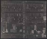
1. [Insurance maps of Ann Arbor, Washtenaw Co., Michigan

1916. Sanborn Map Company. Sanborn Map Company, June 1916]. Negative photostat of University of Michigan central campus area. 1 map: photstat; sheets 49 x 40 cm.

1916. Sanborn Map Company. Sanborn Map Company, June 1916]. Negative photostat of University of Michigan central campus area. 1 map: photstat; sheets 49 x 40 cm.
2018. Wisconsin--Sauk County. This data layer represents buildings for Sauk County, Wisconsin in 2018. It is a feature class within the geodatabase, 'Sauk_Buildings_2018.gdb'. [...
2020. Wisconsin--Sauk County. This data layer represents buildings for Sauk County, Wisconsin in 2020. [The creation of the subsequent building footprint data was executed to ca...
2017. Wisconsin--Sauk County. This polygon data layer represents buildings in Sauk County, Wisconsin at year-end 2016. It is a feature class within the geodatabase, Sauk_Buildin...
2019. Wisconsin--Sauk County. This data layer represents buildings for Sauk County, Wisconsin in 2019. [The creation of the subsequent building footprint data was executed to ca...
![High Resolution Orthoimagery, Spring 2018 [Minnesota--Hennepin County]](https://geo.btaa.org/rails/active_storage/representations/redirect/eyJfcmFpbHMiOnsibWVzc2FnZSI6IkJBaHBBdkdNIiwiZXhwIjpudWxsLCJwdXIiOiJibG9iX2lkIn19--d3064ebbe6cd7d93a93d003b1014e2ea496a5974/eyJfcmFpbHMiOnsibWVzc2FnZSI6IkJBaDdCem9MWm05eWJXRjBTU0lKYW5CbFp3WTZCa1ZVT2hKeVpYTnBlbVZmZEc5ZlptbDBXd2RwQWNndyIsImV4cCI6bnVsbCwicHVyIjoidmFyaWF0aW9uIn19--fb19b03b9eb4e78013d4cfb2b84169f3537e0279/d2d3e11d-c902-4f4f-8b97-cb6a06516a9d.jpeg)
Minnesota--Hennepin County. This dataset contains leaf-off natural color digital orthophoto imagery produced at 3-inch resolution from new aerial photography captured in May 2...

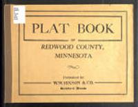
1921. W.W. Hixson & Co. Plat book of Redwood County, Minnesota, containing an outline map of the county and plats of all townships showing location of roads, schools, chur... W.W. Hixson & Co.

1816-2002. Indiana Historic Maps provides images of a small portion of maps that focus on Indiana. The majority of this collection focuses on maps produced pr...
The Indiana Spatial Data Portal (ISDP) provides access to more than 30 terabytes of Indiana geospatial data. Most datasets are available to the pub... Indiana University.
2007. Geological Survey (U.S.) and Sanborn Mapping. Provide FEMA compliant elevation, topography and contour map of Winnebago County, Illinois. Provide Bare Earth DEM (vegetation removal) of Winnebag...